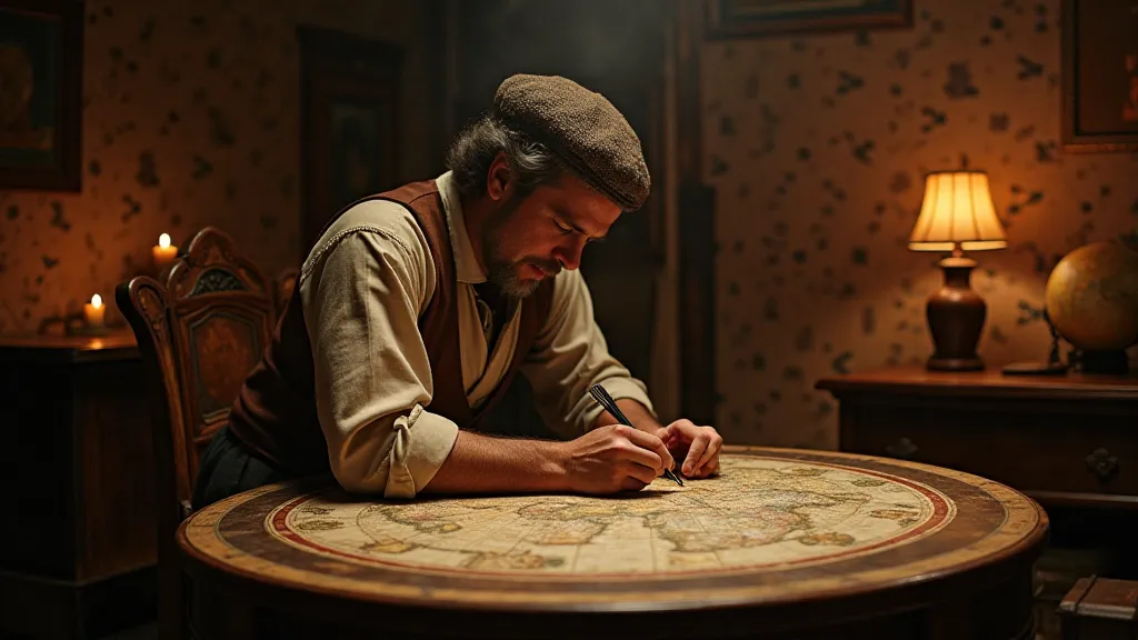
The Evolution of Map Projections on Antique Globes
Antique globes are not just decorative objects; they are tangible representations of how humans have perceived and understood the world throughout history. A crucial element in this understanding lies in the map projections used to depict the Earth’s surface on a spherical form. While seemingly straightforward, creating a flat map from a globe is a complex task, and the methods employed have evolved significantly over the centuries, impacting the accuracy and distortions visible on antique globes. These distortions are a testament to the ingenuity – and the limitations – of early cartographers.
Early Globemakers and the Trivial Projection
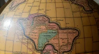
Early globe makers, working in the 16th and 17th centuries, often relied on what’s now referred to as the “trivial projection.” This essentially meant stretching the map to fit the globe's surface. It's a simple approach, but it doesn’t account for the fundamental distortions that are inevitable when projecting a sphere onto a plane. Consequently, these early globes, while beautiful, often showed considerable inaccuracies in landmass sizes and positions. They were more artistic representations of existing flat maps than accurate geographical models. The selection of imagery and detail were often based on what was available in contemporary flat maps, and the artistic license taken by the globe maker.
Think of it like this: the globe makers were largely copying existing flat maps of the time, transferring them to a spherical form. If the original flat map contained errors, those errors would be perpetuated and amplified on the globe. For example, the mythical lands often appearing on early globes, like Hyperborea, were frequently carried over simply because they were present in the flat maps being used. These additions demonstrate that early globe-making was not solely about accurate representation; artistry and prevailing beliefs played a significant role.
The Rise of Conformal Projections and the Challenge of Distortion
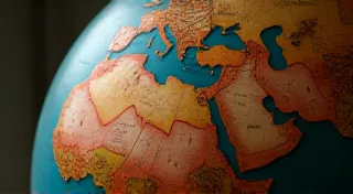
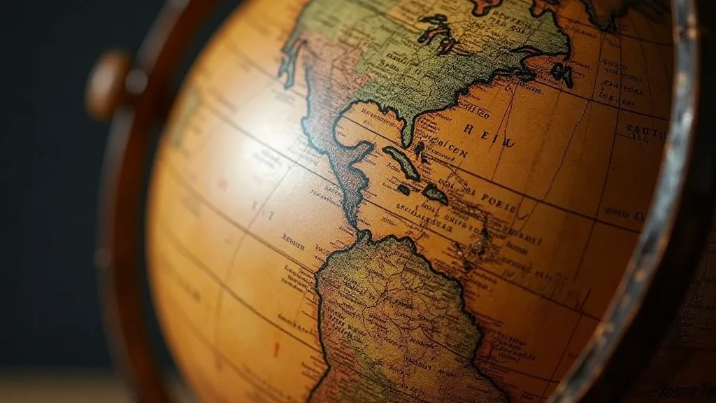
As cartography advanced, the desire for greater accuracy increased. Conformal projections, which preserve the shape of landmasses, began to gain popularity. The Mercator projection, introduced by Gerardus Mercator in 1569, is the most famous example. While revolutionary at the time, its inherent drawback is the dramatic exaggeration of areas closer to the poles. This meant that Greenland, for instance, appeared far larger than it actually is compared to Africa. Early globes using Mercator projections demonstrate this exaggeration, affecting our visual understanding of the relative sizes of continents. The very act of representing a three-dimensional sphere on a two-dimensional surface necessitates compromises, and the Mercator projection, while preserving shape, could not avoid distorting area.
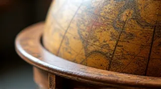
However, it’s important to remember that Mercator wasn’s originally designed for navigation on a globe. It was created for use on flat nautical charts, where preserving shape was more crucial than accurately representing area. The adaptation of the Mercator projection to globes created a visual disconnect that required careful consideration. Understanding how these projections were implemented required both technical skill and an artistic sensibility. The aesthetic appeal of an antique globe is often intertwined with its historical context and the challenges faced by the globe maker in faithfully reproducing what was known about the world at the time. The restoration of the intricate cartouches often found on these globes – the decorative title panels – demands a skilled hand and a deep appreciation for the artistry involved; learn more about The Art of Cartouche Restoration: Recreating Lost Details.
Equatorial and Cylindrical Projections: Different Approaches to Distortion
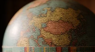
Other projections, like equatorial and cylindrical projections, offered alternative ways to depict the Earth. These methods aimed to reduce distortions in specific regions, often at the expense of increasing distortions elsewhere. The choice of projection depended heavily on the globe maker's purpose and the intended audience. Globes intended for scientific study might prioritize certain types of accuracy, while those designed for display might emphasize aesthetic appeal over precise geographical representation. Early globe makers faced the challenge of balancing accuracy with artistic expression, often selecting projections that suited their overall vision. The very materials used – from the paper and paint to the construction of the globe itself – influenced the final product; investigate The Materials of Antique Globes: Paper, Paint, and Construction for a deeper dive.
The Impact of Exploration on Cartographic Knowledge
The growth of global exploration during the 16th, 17th, and 18th centuries had a profound effect on the accuracy of map projections. As explorers ventured into uncharted territories, they brought back valuable data that challenged existing beliefs and prompted revisions to existing maps. The process of incorporating this new information into globe representations was often complex, requiring cartographers to reconcile conflicting accounts and adjust projections to accommodate new landmasses and coastlines. The changing understanding of the world directly influenced the evolving appearance of antique globes, making them not only works of art but also historical records of humanity’s expanding knowledge. The story of cartography is inextricably linked to the history of exploration; discover how The Influence of Exploration on Antique Globe Cartography shaped the world we see represented on these treasured artifacts.
The 18th and 19th Centuries: Refinements, Surveying, and New Projections
The 18th and 19th centuries witnessed significant refinements in map projections. Mathematicians and cartographers developed new methods to minimize distortions and improve the overall accuracy of globe representations. The increasing availability of accurate surveying data and improved understanding of the Earth’s shape also contributed to these advancements. Globes from this period showcase a noticeable shift towards greater geographical fidelity, although distortions always remain a factor. The development of more sophisticated mathematical tools allowed cartographers to create projections that were more closely aligned with the shape of the Earth. The emphasis shifted from simply reproducing existing maps to creating entirely new projections based on scientific principles.
Preserving the Appearance of Age: Patina and Restoration
Maintaining the aged appearance of antique globes – the patina – is a delicate process that requires careful consideration. The patina is a layer of accumulated dirt, grime, and oxidation that gives antique globes their unique character. While it can be tempting to remove this layer and restore the globe to its original condition, doing so can erase valuable historical information and diminish its aesthetic appeal. Experienced restorers understand the importance of preserving the patina while addressing any structural issues or damage. The careful application of conservation techniques helps to ensure that antique globes retain their historical integrity and visual charm.
Understanding the Legacy: Globes as Historical Documents
Examining the evolution of map projections on antique globes offers a fascinating window into humanity's evolving understanding of the world. These representations aren't merely artistic endeavors; they are historical documents that reveal the cartographic knowledge, technological limitations, and cultural perspectives of their time. When repairing or restoring antique globes, appreciating the original projection used is vital – it tells a story about the globe’s history and its place within the broader narrative of cartography. The interplay of science, art, and exploration is beautifully encapsulated within these spherical representations of our planet.